WLBT FIRST ALERT WEATHER
HOT & HUMID SUNDAY... THEN RAINFALL
JACKSON, Miss. (WLBT) - Sunday will still be pretty muggy, but A front drops south late Sunday, which should bring better rain chances for areas north of I-20. Because of that, the Heat Advisory that’s been up since Friday won’t continue into Sunday. Still, some spots where storms are less likely could feel close to 105°F Sunday afternoon, so there’s still a limited risk for heat stress.
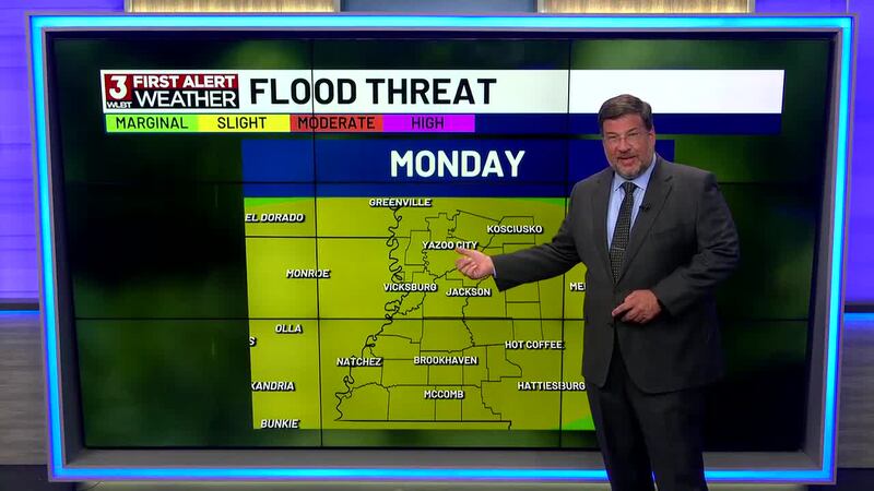
A tropical system near the Yucatan/western Gulf is expected to send a lot of moisture into the Lower Mississippi Valley next week. A weather system and a front will move in and stall out Monday–Wednesday, bringing rounds of rain—some of it heavy. Rain chances stay good Thursday into Friday as what’s left of that tropical wave moves through.
Right now there’s a limited flash flooding threat for the whole area through at least midweek because rain could fall hard and fast, and storms may track over the same spots. 2–4 inches (with higher local totals) is possible Monday–Wednesday; if trends hold, another 1–3 inches could fall Thursday–Friday.
Want more WLBT news in your inbox? Click here to subscribe to our newsletter.
See a spelling or grammar error in our story? Please click here to report it and include the headline of the story in your email.

Copyright 2026 WLBT. All rights reserved.