WLBT FIRST ALERT FORECAST
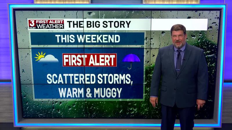
Showers & Thunderstorms for the Weekend
JACKSON, Miss. (WLBT) - A good southerly flow is increasing heat and humidity over the southeast. That combo causes instability in the atmosphere... in other words: increased rain chances ahead.
Looks like a warm, muggy weekend with storms popping up both days: Saturday should be partly sunny to start, then showers and thunderstorms become likely after about 1pm with a high near 86 and a decent chance of heavier downpours in storms. Saturday night calms down some, with a few showers or storms possible before midnight and a low around 72, plus a bit of a breeze and some higher gusts. Sunday stays warm near 87, but it’s the wetter day overall—off-and-on showers in the morning, then more showers and thunderstorms likely into the afternoon and evening. Sunday night keeps a good chance of storms early, then things gradually taper off later, with lows around 73.
Next week looks hot and mostly dry overall, with only a small, hit-or-miss storm chance most afternoons. Heat stress concerns will increase, especially Tuesday through Thursday, as highs in the 90s will feel like 100°F .
Want more WLBT news in your inbox? Click here to subscribe to our newsletter.
See a spelling or grammar error in our story? Please click here to report it and include the headline of the story in your email.

Copyright 2026 WLBT. All rights reserved.